


Randonnée – Le Rocher Diseur
Office de Tourisme de Montgenèvre
Office de Tourisme de Montgenèvre
Office de tourisme de Montgenèvre
office de tourisme de Montgenèvre
office de tourisme de montgenevre
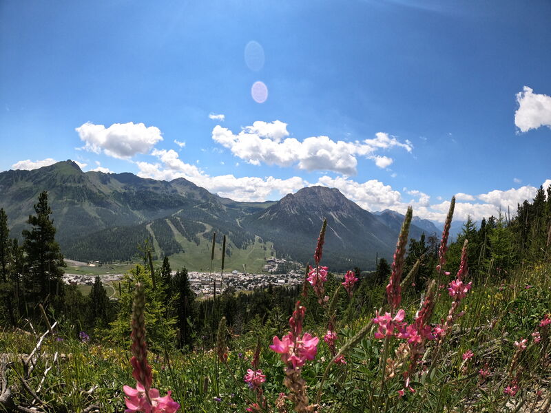
First in the forest, this hike takes you to a magnificent viewpoint over the Clarée valley, then to the high altitude restaurant Les Terrasses.
You can take advantage of this ride to go down on the Monty Express sled. Remember to get a sledge ticket before you go up.
Highest point: 2130 m (Restaurant d'altitude Les Terrasses)
Type of itinerary: loop
Distance: 8 km
Duration: 2 h 50
Elevation +: 370 m
Elevation -: 370 m
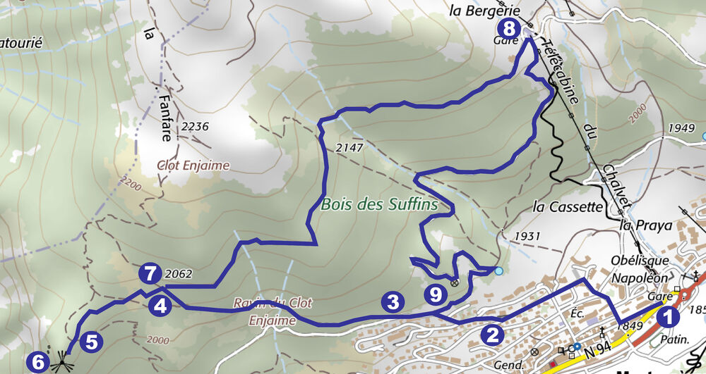
ITINERARY
1. From the Tourist Office, go left (opposite the office) into rue de l'église, then at the first crossroads turn right into rue de la Praya. Follow Rue de la Praya
2. Turn right onto Rue du Rocher Diseur, then right again onto Rue de la Combe. You are now leaving the village
3. Turn right onto the path leading up into the wood, towards Rocher diseur.
4. You reach a track, turn left on the track, to the place called Sous le Rocher Diseur.
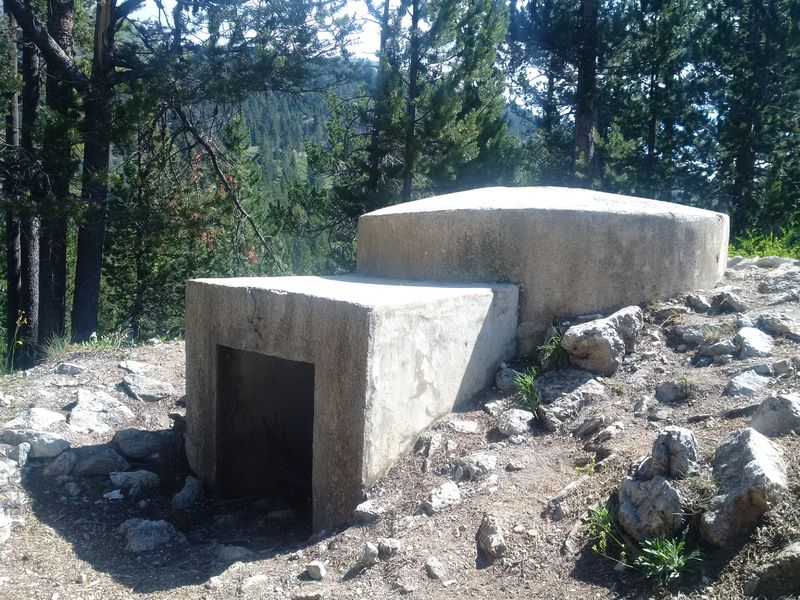
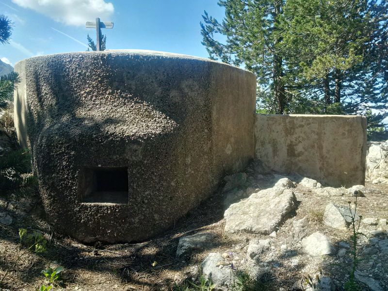
5. Go straight up the rocky spur towards Rocher Diseur. At the top, you can admire a large part of the Clarée valley and in the distance Briançon and its forts. On your right, a military pill
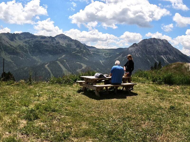
6. Go straight back along the track to the junction with the path you came up on. Do not take the path, continue to follow the track (ETM 10 markings) to the Terrasses restaurant where a beautiful view of the mountain side of Les Chalmettes awaits you.
8. To go back down to the village, turn right just after the children's playground, direction Montgenèvre centre and follow the track which first winds along the rail sledge and then away from it (ETM 10 markings, steep track at the start).
9. At the end of the track, turn left onto Rue de la Combe and follow the same route as before to find the Tourist Office.
From 01/05 to 31/10.
Languages spoken : english, french and italian
Rates
Free access.
Practical information
- Car park
- Picnic area
- Play area
- Public WC
Environments
- Close to a public transportation
- Bus stop < 500 m
- Near shuttle stop
- Station district
- Close to GR footpath
- Forest location
- Lake 5 km away
- Mountain location
- Mountain view
- Panoramic view

Randonnée – Le Tour des Forts par le Télémix des Chalmettes et le Télésiège des Gondrans

Aire de pique-nique du Chalvet

Randonnée – Le Lac Gignoux par le Télémix des Chalmettes et le Télésiège des Gondrans
